


PRECINCT PRAIRIE TOWNSHIP, Holmes County, Ohio
About
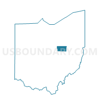
Outline

Summary
| Unique Area Identifier | 647983 |
| Name | PRECINCT PRAIRIE TOWNSHIP |
| County | Holmes County |
| State | Ohio |
| Area (square miles) | 30.69 |
| Land Area (square miles) | 30.66 |
| Water Area (square miles) | 0.03 |
| % of Land Area | 99.91 |
| % of Water Area | 0.09 |
| Latitude of the Internal Point | 40.62975870 |
| Longtitude of the Internal Point | -81.93526780 |
Maps


Graphs
Select a template below for downloading or customizing gragh for PRECINCT PRAIRIE TOWNSHIP, Holmes County, Ohio


Neighbors
Neighoring Voting District (by Name) Neighboring Voting District on the Map
- Voting District CLINTON TWP 2, Wayne County, OH
- Voting District FRANKLIN TWP 1, Wayne County, OH
- PRECINCT HARDY, Holmes County, OH
- PRECINCT MONROE TOWNSHIP, Holmes County, OH
- PRECINCT RIPLEY TOWNSHIP, Holmes County, OH
- PRECINCT SALTCREEK TOWNSHIP, Holmes County, OH
- Voting District SALT CREEK TWP 1 FREDERICKSBURG, Wayne County, OH
Top 10 Neighboring County Subdivision (by Population) Neighboring County Subdivision on the Map
- Hardy township, Holmes County, OH (5,649)
- Salt Creek township, Wayne County, OH (4,309)
- Salt Creek township, Holmes County, OH (4,252)
- Franklin township, Wayne County, OH (3,872)
- Prairie township, Holmes County, OH (3,133)
- Clinton township, Wayne County, OH (3,081)
- Ripley township, Holmes County, OH (2,338)
- Monroe township, Holmes County, OH (1,573)
Top 10 Neighboring Place (by Population) Neighboring Place on the Map
Top 10 Neighboring Unified School District (by Population) Neighboring Unified School District on the Map
- East Holmes Local School District, OH (20,863)
- West Holmes Local School District, OH (18,225)
- Southeast Local School District, OH (17,897)
- Triway Local School District, OH (12,849)
Top 10 Neighboring State Legislative District Lower Chamber (by Population) Neighboring State Legislative District Lower Chamber on the Map
Top 10 Neighboring State Legislative District Upper Chamber (by Population) Neighboring State Legislative District Upper Chamber on the Map
Top 10 Neighboring 111th Congressional District (by Population) Neighboring 111th Congressional District on the Map
Top 10 Neighboring Census Tract (by Population) Neighboring Census Tract on the Map
- Census Tract 9764, Holmes County, OH (8,618)
- Census Tract 17, Wayne County, OH (7,518)
- Census Tract 9767, Holmes County, OH (4,345)
- Census Tract 18, Wayne County, OH (3,872)
- Census Tract 19, Wayne County, OH (3,081)